
Effortless Redistricting. Fast, Accurate, and Data-Driven.
Our advanced GIS-based redistricting process helps school districts reallocate students efficiently, balancing capacity levels in minutes instead of months.
Whether you’re opening or closing a school, you need accurate information on how to assign the remaining students to get the maximum use from your buildings.
We will incorporate the criteria you want in drawing the attendance boundary lines into accurate scenarios that will help explain the changes to your patrons. Our process for redrawing the lines is open and easy-to-follow.
- Faster, More Accurate Redistricting
- More Efficient Building Use
- Balanced, Equitable Enrollments
Number of Redistricting Projects
Redistricting Can Be a Nightmare. It Doesn’t Have to Be.
DO YOU STRUGGLE WITH:
• Redistricting delays due to outdated, manual methods?
• Staff overwhelmed with boundary changes and capacity planning?
• Unbalanced schools and community pushback over zoning decisions?
• A lack of the right technology to analyze student distribution effectively?
With our GIS-driven redistricting, school districts can make faster, more accurate decisions with data-backed confidence.
GIS Applications/ Demographic Data Vendors
Number of Students in Largest Redistricting Project
GIS-Driven Redistricting for Smarter, Faster School Planning
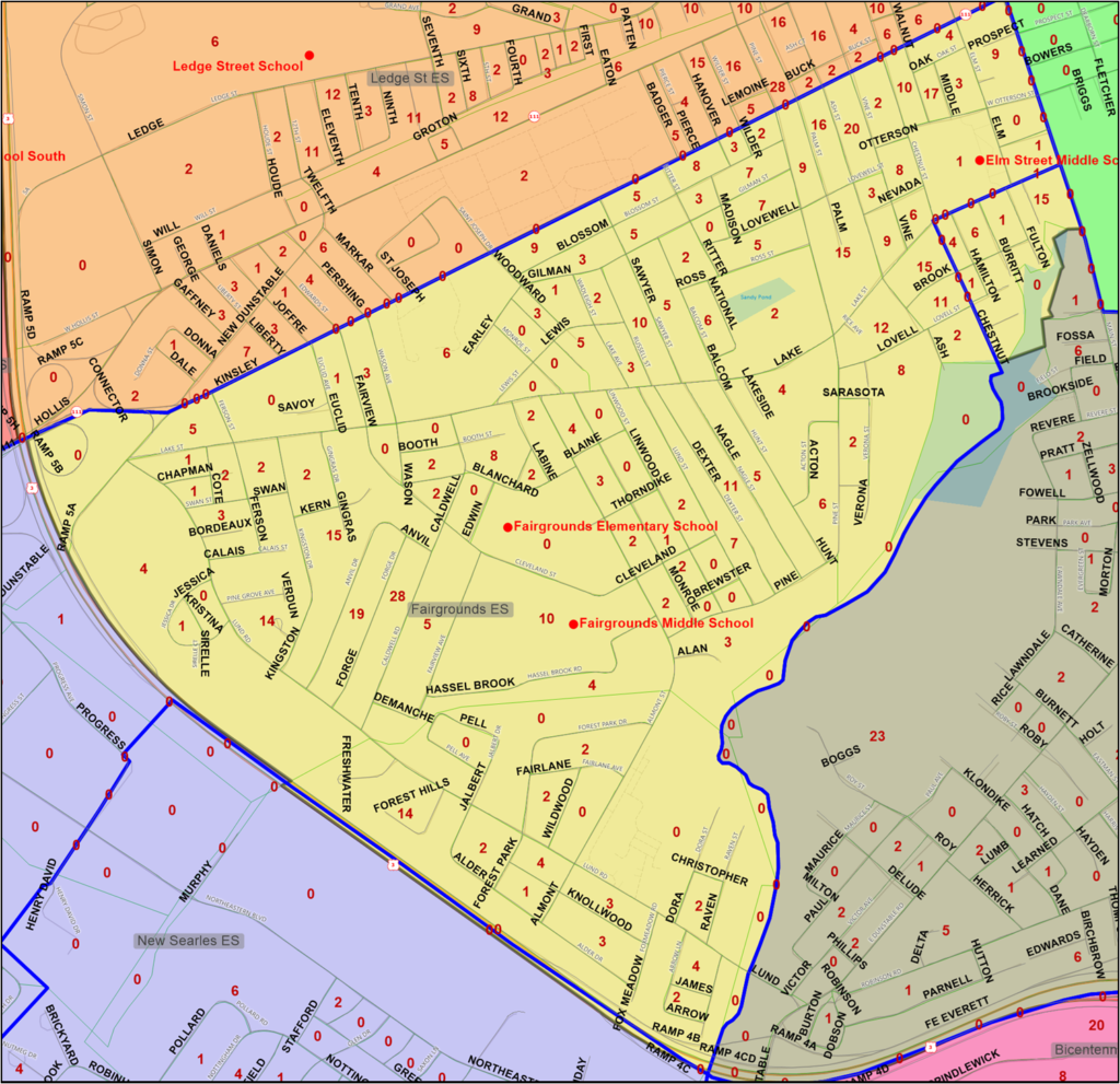
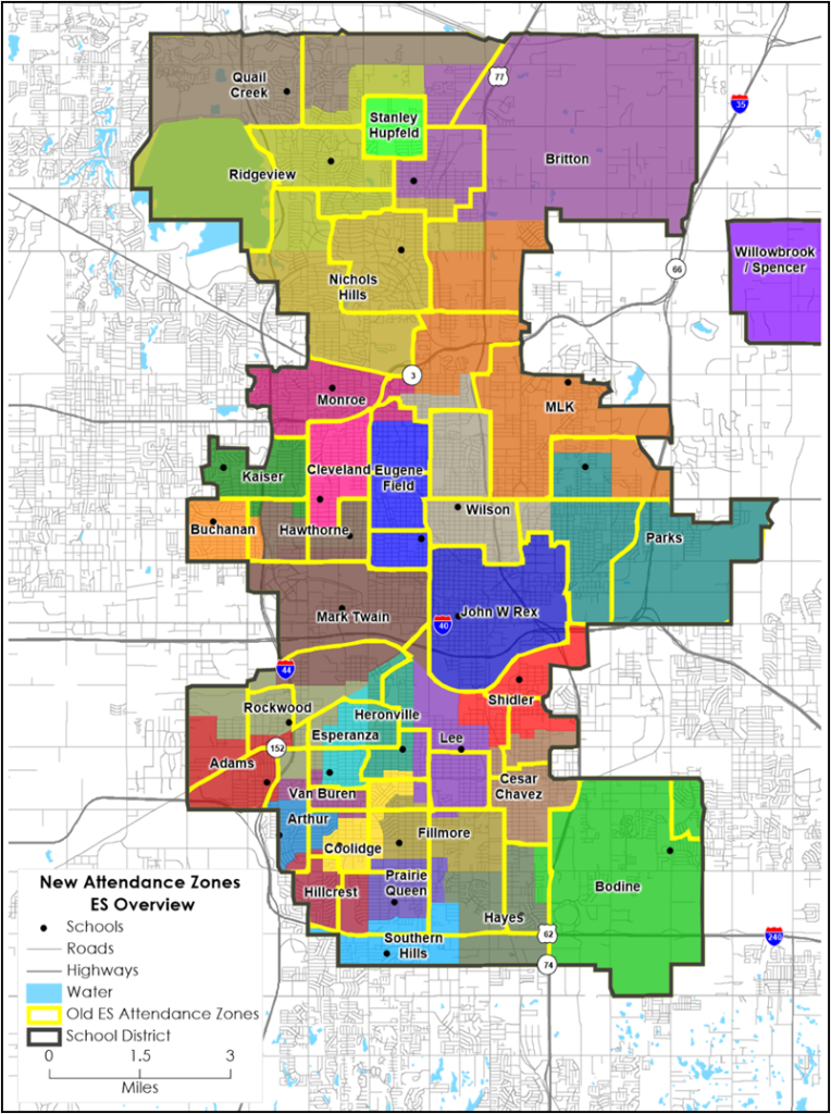
We understand that redistricting is one of the most complex and time-consuming challenges school districts face. Without the right tools and expertise, districts are left with overcrowded schools, transportation inefficiencies, and limited options.
As pioneers in GIS-based redistricting, our firm was one of the first beta testers in the country for national GIS applications, helping develop the technology that makes redistricting faster, more accurate, and data-driven. We provide school administrators with an efficient, online process that allows multiple redistricting scenarios to be created in minutes—not months.
Let us transform your district’s redistricting process and make boundary planning seamless.
How We Can Help
Faster, More Accurate Redistricting
Our advanced GIS technology enables rapid scenario planning so you can adjust attendance boundaries efficiently, which means districts save time and reduce stress.
Optimized School Capacity
We ensure balanced enrollment distribution across schools so you maximize building use, which means fewer overcrowded classrooms and underutilized facilities.
Equitable & Transparent Planning
Our data-driven redistricting process provides fair, objective solutions so communities stay informed and engaged, which means fewer disputes and a smoother transition.
How It Works
Data Collection & GIS Mapping
1
We gather and analyze demographic and school capacity data so you have a complete, accurate foundation for redistricting decisions.
Scenario Development & Analysis
2
We use advanced GIS tools to generate multiple redistricting scenarios so you can evaluate the best options quickly and effectively.
Final Recommendations & Implementation
3
We provide expert guidance on selecting the optimal plan so you can implement changes smoothly with community support.
What Makes Us Different
GIS-Based Redistricting
Instant, accurate boundary adjustments using advanced GIS tools.
Multiple Scenario Planning
Generate and compare redistricting options in real-time.
Optimized School Capacity
Balanced enrollments to prevent overcrowding and underutilization.
Demographic Trend Integration
Future-proof boundary planning with housing & population trends.
Community Engagement Support
Tools to help districts communicate and gain stakeholder buy-in.
Budget-Friendly Planning
Accurate projections to prevent unnecessary spending.
Frequently Asked Questions
Why should we use GIS-based redistricting instead of manual methods?
Traditional methods like push pins and post-it notes are slow, imprecise, and difficult to adjust. Our GIS-based approach allows school districts to quickly test multiple scenarios, ensuring faster, more accurate, and equitable boundary decisions.
How can we ensure our community accepts the redistricting plan?
Our process includes data-driven transparency and community engagement strategies to help districts communicate boundary adjustments clearly, reducing resistance and ensuring smoother implementation.
What makes your firm different from other redistricting services?
We were one of the first beta testers for national GIS applications, meaning we helped shape the technology that districts now rely on. Our expertise ensures precision, efficiency, and customized solutions for every district.
Can you account for future housing developments in your projections?
Yes! We integrate housing trends, demographic shifts, and population growth into our redistricting analysis so districts can make decisions that remain effective for years to come.
How quickly can you generate redistricting scenarios?
With our GIS-powered system, we can create multiple redistricting scenarios in minutes, allowing school administrators to evaluate and adjust boundary plans with unmatched speed and flexibility.